1980 PRELIMINARY
REPORTS
Hurricane
Allen (5)
Hurricane Bonnie (2)
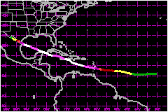
Hurricane Charley (1)
Tropical Storm Danielle (TS)
Hurricane Earl (1)
Hurricane Frances (3)
Hurricane Georges (1)
Tropical Storm Hermine (TS)
Hurricane Ivan (2)
Hurricane Jeanne (2)
Hurricane Karl (1)
|
Hurricane Allen was the second most severe Atlantic
hurricane in modern records and will be long remembered and studied. Allen
was an unusual hurricane in a number of ways.
| 1) |
A Cape Verde hurricane is rarely observed so early
in August. |
| 2) |
The forward motion of Allen along most of its track
was unusually fast...close to 23 mph ...except for a decrease in
forward speed over the Gulf of Mexico, during the 2 days prior to
landfall. |
| 3) |
The rapid development of Allen east of the Lesser
Antilles, while moving westward at more than 23 mph, was unusual
although similar to Hurricane Flora in 1963. |
| 4) |
The movement of Allen into the Caribbean, where strong
westerly shear had prevailed, appeared likely to doom the hurricane.
On the contrary, Allen used the strong shear to strengthen even
further. The strong anticyclone in the upper atmosphere associated
with Allen's outflow moved along with the same forward speed as
Allen and converted the westerlies to southerlies. This helped accelerate
the outflow and allowed the hurricane to reach record strength. |
| 5) |
Allen reached the top of the Saffir-Simpson Scale
(Category 5) 3 times. This event had not been observed before. It
obtained the lowest pressure ever recorded in the eastern Caribbean...911
mb...on 5 August while south of Puerto Rico. After weakening near
Haiti and Jamaica, Allen again strengthened and a record minimum
pressure of 899 mb was recorded by NOAA reconnaissance aircraft
on 7 August. This is not only the lowest pressure ever observed
in the western Caribbean, but the lowest ever observed in the western
Caribbean, but the lowest ever observed by a reconnaissance aircraft
in an Atlantic hurricane, and the second lowest ever recorded in
the Atlantic, Caribbean and Gulf of Mexico according to modern records.
Allen began losing strength for a second time as the center passed
near the north coast of the Yucutan peninsula on 8 August. Regaining
strength again over the open waters of the Gulf of Mexico, Allen's
central pressure dropped to 909 mb as recorded by an Air Force reconnaissance
aircraft on 9 August. This is the lowest pressure ever measured
in the western Gulf of Mexico. |
| 6) |
The center of Allen did not cross land at any location
until it moved inland north of Brownsville, Texas. It did a remarkable
job of 'broken field running' through the Caribbean at speeds of
17 to 23 mph. The eye passed between Barbados and St. Lucia, Haiti
and Jamaica, and Cuba and Jamaica. It then passed north of the Cayman
Islands, and between Cuba and the Yucutan peninsula. Even after
reaching the Texas coast, Allen hesitated long enough to weaken
to 945 mb, and then moved inland north of Brownsville with the highest
tides and winds over the least populated section of the Texas coast. |
a. Synoptic History
A disturbance moved off the northwest African coast on 30 July.
By 1 August the second tropical depression of the season had developed
when satellite pictures indicated the consolidation of two circulation
centers within the large cloud mass of the African disturbance.
Allen rapidly reached tropical storm strength in the early
morning hours of 2 August and hurricane strength that evening. By the
time the first reconnaissance aircraft was able to penetrate the center
during the afternoon of 3 August, Allen had winds of 127 mph and a minimum
pressure of 967 mb. The pressure had dropped to 951 mb by that evening
as the eye passed just north of Barbados and south of St. Lucia.
The hurricane continued westward into the Caribbean a 17 to
23 mph, reaching its first milestone when the minimum pressure fell to
911 mb south of Puerto Rico during the evening of 4 August.
As the large circulation of Allen began to spread over Hispaniola on 5
August, a turn toward the west-northwest brough the center just south
of Haiti's southwestern peninsula that evening. The same northward jog
has been observed in a number of large hurricanes, and be due to pressure
falls over Hispaniola as large heat releases occur in mountain cloudbursts.
The hurricane weakened as its circulation interacted with mountainous
terrain of Haiti and Jamaica.
Thereafter, Allen resumed a more westerly course passing just north of
Jamaica and the Cayman Islands on 6 August. Central pressure began to
fall rapidly again as the circulation moved over the warm waters of the
northwestern Caribbean Sea. Allen's second milestone occurred on the afternoon
of 7 August when a record breaking minimum pressure of 899 mb was observed
in the Yucutan Channel.
When the southern portion of Allen's circulation moved over the Yucutan
peninsula during the night of 7 August, the moist southerly inflow to
the hurricane's center was cut off. The minimum pressure rose very rapidly
again, reaching 961 mb on the morning of 8 August.
While the hurricane continued west-northwest across the warm waters of
the Gulf of Mexico, rapidly falling pressures resulted in the third milestone
as a minimum pressure was observed the night of 8 August.
Allen's course through the Atlantic and Caribbean was controlled by a
large, warm high pressure system covering the western Atlantic and southern
United States. This system was nearly stationary and may have been partially
reinforced by the warm outflow from Allen. As the hurricane moved into
the Gulf of Mexico, general pressure falls began over the southern United
States, indicating that Allen should begin slowing its rapid forward speed
and possibly turn more toward the north.
The expected decrease in forward speed did not occur until Allen approached
the Texas coast on 9 August. Even though the ridge over the southern states
weakened markedly, its main effect was so slow Allen's forward speed.
The western portion of the ridge did not retreat far enough to allow the
hurricane to turn northward. This spared the heavily populated sections
of the middle and upper Texas coast from storm surge up to 15 feet.
After moving inland on 10 August, Allen continued slowly west-northwest
with winds diminishing rapidly as the circulation encountered mountains
of northern Mexico. By this time the major threat was flash floods in
the mountains.
b. Meteorological Statistics
Reconnaissance flights by Air Force and NOAA crews were outstanding.
There was a total of 72 center fixes made on Allen. Fifty-two were made
by the Air Force and 20 by NOAA crews. Many of the flights were made under
difficult circumstances. On a number of occasions, flights were made into
Allen's circulation when it was very near the mountainous islands of the
Caribbean, where areas of severe turbulence can develop.
Prior to landfall on the Texas coast, an Air Force plane made a fix each
hour for 8 hours...most of them at night. Total flight time was well over
10 hours.
Record low pressures were measured by dropsonde for both the Caribbean
and western Gulf of Mexico. During the NOAA aircraft flight when the 899
mb was measured, the aircraft measured sustained flight level winds of
190 mph and estimated surface winds of 196 mph.
North Windward and southern Leeward Islands strongest winds were on the
north coast of Barbados and the south coast of St. Lucia. Heavy rains
caused flash flooding on St. Lucia.
Allen passed a short distance south of the extreme southwest coast of
Haiti producing extensive damage from winds and flash floods.
Allen passed north of Cayman Islands but Cayman Brac was raked by winds
in excess of 115 mph and sustained considerable property damage.
The extreme northeast coast of the Yucutan peninsula was very near the
center of Allen but remained on the weak side. The northeast Mexican Gulf
coast was also on the weak side. Both of these areas are sparsely populated.
Allen did only a fraction of the damage that had been feared, because
it weakened just prior to reaching the coast, and its path sent the highest
storm surge and strongest winds over the sparsely populated coastal section
between Brownsville and Corpus Christi, Texas.
While Allen was passing south of Cuba winds of gale force swept the lower
Florida Keys. However, there was no significant damage.
The strongest measured winds were 138 mph gusts at Port Mansfield on the
west side of Laguna Madre about 40 miles north of Brownsville. The peak
gust was only 79 mph at Brownsville airport. An oil rig 50 miles east
of Brownsville recorded 138 mph sustained winds. Elsewhere, gusts to 92
mph occurred at Corpus Christi Airport and 109 mph at nearby Aransas Pass.
1. Storm Surge Data
Tides reached levels of 3 to 5 feet above normal along the
upper Texas and western Louisiana coasts, with higher levels in the area
of maximum storm surge from Corpus Christi southward. There is no way
of estimating and maximum storm surge, since it occurred over the unpopulated
section of Padre Island between Brownsville and Corpus Christi. A survey
by aircraft the day after Allen moved inland showed numerous cuts and
washouts over a 50 mile stretch of Padre Island north of where the center
moved inland. It is believed so much water crossed the Island that water
levels in the Laguna Madre were much higher than might be expected.
2. Rainfall Data
Rainfall of 10 to 15 inches fell over south Texas along the
track of Allen for up to 150 miles north and 50 miles south of the center.
More than 16 inches was measured at Falfurrias, and over 15 inches at
Raymondville and Alice. As the remnants of Allen moved through northern
Mexico, orographic lifting produced 5 to 10 inch rains north of Del Rio.
Dryden, Texas recorded over 10 inches. The satellite interpretation method
for rainfall estimates, developed by Woodley and Griffith, was quite successful
with Allen. Twenty four hours prior to landfall this system indicated
a maximum rainfall of 16 inches.
3. Tornadoes
There were at least a dozen tornadoes reported around south
and central Texas. Two were confirmed in Brownsville which damaged 30
houses. More than 8 tornadoes were observed over inland areas west and
north of Corpus Christi. The only significant damage was in Bishop were
several buildings sustained heavy damage and part of the high school roof
was blown off. Tornadoes in central Texas injured about 20 people at campground
near San Marcus and caused an estimated $50 Million
damage at the Austin Airport, primarily to hangars and corporate jets.
c. Casualty and Damage Statistics
There were 249 deaths attributed to Allen; 220 in Haiti,18
in St. Lucia, 8 in Jamaica, 2 in Texas and 1 in Guadeloupe.
Preliminary damage estimates in Barbados total $1.5
Million. About 500 houses were damaged or destroyed. There were
no reports of deaths. Eighteen people were killed on St. Lucia which sustained
heavy damage. The only other death reported in the islands was on Guadeloupe.
Two hundred twenty people were reported killed and 835,000 left homeless.
Damage was estimated to be more than $400 Million.
About one half of the nation's coffee crop was destroyed.
There was extensive damage along the immediate northeast coast of Jamaica,
but only minor damage elsewhere. Eight people were reported killed.
There were no reports of significant damage from Cuba although 3 people
died.
No reports of significant damage have been received from Mexico.
There were only 2 deaths directly attributed to Allen, and these were
drownings in the Corpus Christi area. The reported indirect deaths were:
13 in an oil company evacuation helicopter which crashed while taking
workmen from the Louisiana offshore oil rigs. Four in an offshore oil
rig collapse off the Louisiana coast, three fishermen swept off the jetties
by large swells in Galveston area, and two victims of heart attacks. There
were also several deaths in automobile accidents during the period of
evacuation. Estimated total US damage caused by Allen was $300
Million.
The major damage in Louisiana was the destruction of two $30
Million oil drilling platforms and damage to other platforms off
the Louisiana coast. It has been calculated that nearly 500,000 people
evacuated the coastal sections of Texas and Louisiana.
Maximum Intensity For Hurricane
Allen
31 July - 11 August, 1980
Date/Time
(UTC) |
Position |
Pressure
(mb) |
Wind Speed
(mph) |
Stage |
| Lat. (°N) |
Lon. (°W) |
| 07/1800 |
21.8 |
86.4 |
899 |
190 |
Category 5 Hurricane |
Landfall for Hurricane
Allen
31 July - 11 August, 1980
Date/Time
(UTC) |
Pressure
(mb) |
Wind Speed
(mph) |
Stage |
Landfall |
| 10/0600 |
945 |
115 |
Category 3 Hurricane |
Laguna Madre,
Texas |
|