1991 PRELIMINARY
REPORTS
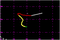
Tropical
Storm Ana (TS)
Hurricane Bob (3)
Hurricane Claudette (3)
Tropical Storm Danny (TS)
Tropical Storm Erika (TS)
Tropical Storm Fabian (TS)
Hurricane Grace (2)
|
a. Synoptic History
Analyses of upper-air data show that the incipient circulation
of Grace formed primarily from a mid-level low between Bermuda and the
Dominican Republic on 23 October. The circulation slowly developed downward.
A 12 mile west (270°) wind report from the German Ship "Holtsencarrier"
indicated that the low reached the surface a little to the north of the
ship by 1800 UTC on the 25th.
Grace was initially subtropical in character. Several observations support
this classification. First, the surface low center was cloud-free when
it formed and remained generally without deep convection until the 27th.
Second, when cloudiness near the center began to increase, it consisted
of several low to mid-level cloud swirls, indicating a broad circulation
with light winds near the center. This was confirmed by a series of 3-hourly
observations from a ship (tentatively identified as the Walter Jacob from
Germany). The ship encountered fairly light winds near the center. In
contrast, observations from the ship show that 35 mile winds blew at large
(100-300 nautical miles) radii, both east and west of the center. Wind
speeds of similar strength occurred well-north of the center, and increased
to 39 miles at Bermuda and nearby ships by the 26th. The best track reflects
these reports by showing that the system intensified from a subtropical
depression to a subtropical storm at 0600 UTC on the 26th. Finally, all
satellite classifications during this period by the NHC Tropical Satellite
Analysis and Forcast Unit, the Air Force Global Weather Center (AFGWC),
and the NESDIS Satellite Analysis Branch (TSAF, USAF and SAB, respectively
in figs 2 and 3) were subtropical.
Cloudiness near Bermuda, which originated a few days earlier near the
U.S. southeast coast, became increasingly convective and banded as it
was enveloped by the expanding circulation. The clouds gradually wrapped
inward toward the circulation center from the west between 25 and 27 October.
Convection began to persist near the center at about 1800 UTC on the 27th.
The first reconnaissance flight into the system, by an Air Force Reserve
Unit aircraft, also occured then and encountered winds which had become
strongest near the circulation center. These characteristics are consistent
with the pressure of a tropical system and (although AFGWC continued making
subtropical classifications throughout the system's lifetime) are used
as an indication that the subtropical storm had transformed into Tropical
Storm Grace.
The organization and concentration of convection continued to increase
near the center late on the 27th. Based on satellite intensity estimates
and a reconnaissance report estimating surface wind speeds of 75 miles,
Grace was upgraded to a hurricane on the best track at 0000 UTC 28 October,
although flight-level winds did not reach that threshold for about another
36 hours.
Grace initially followed a sinuous course toward the northwest at about
12 miles. As it did so, an extratropical cyclone formed well to the north,
off the New England coast. The extratropical cyclone rapidly became powerful
and the strong, mostly westerly deep-layer mean flow around its southern
flank quickly came to dominate the steering of Grace. The hurricane slowed
and made a hairpin turntoward the east on 28 Ocober. Grace then accelerated
markedly, from about 3 miles at midday on the 28th to around 46 miles
only 24 hours laters.
Reconnaissance reports of near 81 miles surface and flight-level winds
just west of the center imply that Grace still had a storm-relative circulation
of about 81 miles on the morning of the 29th. However, the rapid eastward
motion, superimposed on this circulation, produced a very asymmetrical
surface wind distribution. Relatively light winds occurred to the north
of the center. Winds of only about 23 miles were observed at Bermuda as
the hurricane center passed by about 45 nautical miles to the south near
0800 UTC. On the other hand, very strong winds were present to the south
of the center. When the reconnaissance aircraft exited the hurricane center
toward the south near 1400 UTC, it encountered wind speeds at 850 mb that
exceeded 115 miles along about a 15 nautical mile segment of the flight
track centered about 30 nautical miles south of the center. The maximum
flight-level wind speed was 128 miles. Surface wind estimates were near
115 miles. Using this data, the maximum intensity of Grace is estimated
to have been 104 miles at 1400 UTC 29 October.
Grace turned toward the east-northeast during the afternoon of 29 October
and was overtaken by a vigorous cold front associated with the extratropical
cyclone. The merger occurred near 1800 UTC 29 October, when the rapidly-moving
cold front undercut and quickly destroyed Grace's low-level circulation.
Animation of satellite imagery showed that the remnant mid and upper-level
moisture from Grace became caught up in the outer part of the extratropical
cyclone circulation, far from the extratropical storm center. The remnants
became indistinguishable within a day of the merger.
b. Meteorological Statistics
Bermuda reported tropical (or subtropical) storm force winds
on 3 hourly and 1 immediate observations, all more than 15 hours prior
to the closest approach of the hurricane, and before passage of the intense
cold front at about 0810 UTC 29 October. The highest of those winds was
41 miles at 0300 UTC on the 27th. The peak gust of 61 miles occurred during
the previous hour.
c. Casualty and Damage Statistics
There were no reports of damage or casualties on Bermuda
due to Grace.
Grace was a relatively large system, owing to its early subtropical nature.
It generated large swells, from about 15 feet at buoy 41001 offshore
from North Carolina to about 10 feet near the Florida coast. Because these
swells were noted near the U.S. southeast coast prior to the passage of
the cold front they are attributed directly to Grace. Those waves, in
conbination with spring tides, caused isolated minor beach erosion, but
no reported significant damage or casualties from North Carolina southward
through Florida.
As the extratropical cyclone intensified, Grace became only a secondary
contributor to subsequent extroadinary sea conditions reported over much
of the western North Atlantic during the last week of October and first
few days of November. Treacherous swells, surf, and associated coastal
flooding occurred behind the cold front along portions of the Atlantic
shoreline extending from Puerto Rico and the Dominican Republic, to the
Bahamas, the United States, Canada and Bermuda. While irrefuctable evidence
is not available, there were probably no casualties or damage then which
could be attributed directly to Grace. Instead, it is beleived that the
much larger extratropical cyclone was the primary phenomenon at blame.
Gale force winds with gusts to 69 miles covered a huge area behind the
cold front. Along Bermuda's north shore they destroyed 4 or 5 boats and
caused minor damage to vegetation. Sustained winds of 92 miles and open-water
heights to 101 feet (Canadian buoy 44137) were reported over the
northwestern Atlantic, well to the north of the relatively more local
influence of Grace.
Maximum
Sustained Winds For Hurricane Grace
25 - 29 October, 1991
Date/Time
(UTC) |
Position |
Pressure
(mb) |
Wind Speed
(mph) |
Stage |
| Lat. (°N) |
Lon. (°W) |
| 29/1400 |
31.5 |
61.8 |
982 |
105 |
Category 2 Hurricane |
Minimum
Pressure For Hurricane Grace
25 - 29 October, 1991
Date/Time
(UTC) |
Position |
Pressure
(mb) |
Wind Speed
(mph) |
Stage |
| Lat. (°N) |
Lon. (°W) |
| 29/0000 |
31.8 |
66.8 |
980 |
80 |
Category 1 Hurricane |
|