|
|
|
|
|||||||||||||||||||||||||||||
|---|---|---|---|---|---|---|---|---|---|---|---|---|---|---|---|---|---|---|---|---|---|---|---|---|---|---|---|---|---|
|
2002 PRELIMINARY
REPORTS |
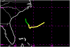
Tropical Storm Cristobal was a relatively weak tropical cyclone that meandered in the western Atlantic prior to being absorbed into a frontal zone. a. Synoptic HistoryThe origin of Cristobal was non-tropical. On 1 August, a surface trough of low pressure extended from the northern Gulf of Mexico across Florida into the western North Atlantic Ocean. This trough moved little over the next few days, spawning Tropical Storm Bertha in the Gulf of Mexico on 4 August, while a second area of low pressure was also developing within the trough near the South Carolina coast. This second low moved slowly eastward and its associated convection gradually became better organized; by 1800 UTC 5 August, when the low was about 150 nautical miles east-southeast of Charleston, South Carolina, it had acquired sufficient organization to be considered a tropical depression. The depression moved slowly south-southeastward over the next day and a half. Development was limited by strong northerly wind shear and a relatively dry environment, and most of the system's convection was confined to the southern portion of the circulation. The surface circulation became elongated in the southwesterly flow in advance of a southward-moving cold front. Nevertheless, a reconnaissance aircraft late on 6 August found that the central pressure had fallen and that the depression had strengthened to a tropical storm. On 7 August, Cristobal began a slow eastward motion as it began to feel some influence of a large mid- to upper-level trough moving off the U. S. east coast. The main convective activity shifted from the south to the southeast, and then to the east quadrant of the circulation by early on 8 August. This reorganization of the convection was accompanied by a modest increase in winds, to 52 mph, although there was apparently no concurrent decrease in central pressure. On 8 August, with additional dry air moving into the circulation
and convection becoming intermittent, Cristobal began a sudden acceleration
to the east-northeast, with its forward speed increasing from roughly
3 to 23 mph over a 12 hour interval. By 1800 UTC, reconnaissance aircraft
reported some difficulty in closing a low-level circulation as Cristobal
was becoming absorbed into the frontal zone, about 300 nautical miles
southeast of Cape Hatteras, North Carolina. Satellite imagery suggests
that the circulation of Cristobal had dissipated within the frontal zone
by 0000 UTC 9 August. b. Meteorological StatisticsA report from ship DGBE of 49 mph at 1800 6 August is not
considered accurate (based on a history of anomalously high wind reports)
and is not included in the table. There were no land-based observations
of tropical storm force winds. Cristobal was operationally upgraded to
a tropical storm based on a reconnaissance flight-level wind report of
55 mph from an altitude of 6300 ft at 2249 UTC 6 August. The strongest
flight-level winds, 68 mph (from 1500 ft) were reported during Cristobal's
rapid acceleration on 8 August, just before the circulation became lost
within the frontal zone.
c. Casualty and Damage StatisticsThere were no reports of damage or casualties associated with Cristobal.
Maximum
Sustained Winds For Tropical Storm Cristobal
Minimum
Pressure For Tropical Storm Cristobal
| ||||||||||||||||||||||||||||