1993
PRELIMINARY REPORTS
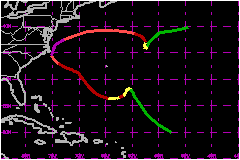
Tropical
Storm Arlene (TS)
Tropical Storm Bret (TS)
Tropical Storm Cindy (TS)
Tropical Storm Dennis (TS)
Hurricane Emily (3)
Hurricane Floyd (1)
Hurricane Gert (2)
Hurricane Harvey (1)
|
The eye wall of Emily, a category 3 hurricane, raked the Outer Banks
of North Carolina on 31 August.
a. Synoptic History
Emily moved off the west coast of Africa and over the Cape
Verde Islands on 17 August as a tropical wave. It took five days for the
disturbance to develop enough of a circulation and convection to be classified
as a tropical depression on the 22nd, while located 700 nautical miles
east-northeast of Puerto Rico.
The depression moved toward the northwest for two days. It then encountered
a weak steering current and became quasi-stationary on the 25th and 26th
and began to intensify. A high pressure ridge built to the north and Emily,
900 nautical miles east of Florida, moved generally westward on the 27th
and 28th.
Emily, under aircraft surveillance, reached tropical strorm strength on
the 25th and briefly became a 75-mph hurricane on the 26th. Wind speeds
fluctuated between 69 and 86 mph during the two-day period of westward
motion. Intensification began in earnest on the 28th and there was a turn
toward the northwest in response to the passage of a mid-latitude trough
to the north.
Emily veered back toward the west-northwest on the 30th and then started
a gradual turn toward the north. Intensification continued until late
on the 31st when the hurricane was moving northward and the eye wall reached
the Outer Banks of North Carolina.
The hurricane reached its peak intensity late on the 31st as the center
of the eye reached its point of closest approach to land... about 20 nautical
miles east of Hatteras Island. Emily was large at this time with a 40
nautical mile inner diameter of the circualar wall cloud surrounding the
center of the hurricane. This is based on Air Force Reserve Unit and NOAA
reconnaissance as well as the Cape Hatteras radar. A portion of the western
eye wall passed over Hatteras Island and the surrounding waters, with
1-minute surface winds estimated between 75 and 115 mph. This caused strong
on-shore winds on the Pamlico Sound side of Hatteras Island and the accompanying
storm surge coastal flooding was up to 10 feet above normal tide levels.
The Atlantic coast maximum surge levels are estimated to be only 1 to
2 feet above normal.
For the record, Emily will be counted as a category 3 hit on the Saffir/Simpson
Hurricane Scale for Hyde and Dare Counties in North Carolina.
Emily was at the westernmost point of a re-curvature around the western
periphery of a large high pressure area when it affected the Outer Banks
and effects over land were minimal elsewhere. By 2 September, Emily had
turned sharply toward the east in response to another mid-latitude trough
and was weakening over colder North Atlantic water. It weakened to a tropical
storm on the 3rd as it moved southward and stalled. By the 5th, Emily
was a tropical depression and moving east-northeastward. Emily became
extratropical on the 6th far out in the Atlantic and quickly dissipated.
b. Meteorological Statistics
The highest sustained wind measurement is 152 mph from an
Air Force plane at 1729 UTC on the 31st, 16 nautical miles west of the
center within a few hours of its point of closest approach to Hatteras
Island. In all, there were 74 Air Force Reserve Unit and NOAA aircraft
fixes of the tropical cyclone center during 7.5 days which is one fix
every 2.4 hours.
The best track maximum wind speed is 115 mph for 12 hours beginning at
1800 UTC on the 31st. One hundred fifteen mph turns out to be a reduction
to 76% of 152 mph, the 10-second aircraft wind at an altitude of 1500
feet. Diamond Shoals Light Tower is located about 15 nautical miles southeast
of Cape Hatteras and its anemometer at 153 feet elevation measured a 2-minute
wind speed of 99 mph at 2200 UTC and a peak 5-second gust of 147 mph,
along with a lowest pressure of 964.5 mb, only 4.5 mb higher than the
aircraft-measured minimum pressure of 960 mb at 2349 UTC.
The National Weather Service Office in Buxton recorded a peak 1-minute
wind of 60 mph with a gust to 98 mph, but the measurement was disrupted
just before the strongest winds are believed to have occurred. A private
citizen in Buxton recorded 75 mph with a gust to 107 mph. Preliminary
analysis at the Hurricane Research Division, NOAA, indicate surface wind
speeds to as high as 115 mph over Pamlico Sound (private communication
from Sam Houston). These strong on-shore winds drove flood waters over
the Sound side of Hatteras Island.
1. Storm Surge Data
A storm surge flood height of 10.2 feet above sea level
at Buxton is the highest reported value.
2. Rainfall Data
The maximum rainfall recorded was 7.5 inches at Buxton and
very little was observed further west. Ocean City, Maryland reported 2.80
inches.
c. Casualty and Damage Statistics
There were 2 deaths attributed to Emily; 1 in North Carolina
and 1 in Virginia.
A preliminary damage estimate for North Carolina is $35
Million, mainly on Hatteras Island. There were 553 dwellings deemed
uninhabitable. About 160,000 persons were evacuated from the barrier islands
of North Carolina, 750 persons from the Virginia coast, 100,000 from the
Maryland coast, 1000 from Delaware and 20,000 from Fire Island, New York.
Maximum Intensity For Hurricane Emily
22 August - 06 September, 1993
Date/Time
(UTC) |
Position |
Pressure
(mb) |
Wind Speed
(mph) |
Stage |
| Lat. (°N) |
Lon. (°W) |
| 01/0000 |
35.6 |
74.9 |
960 |
115 |
Category 3 Hurricane |
|