|
|
|
|
|||||||||||||||
|---|---|---|---|---|---|---|---|---|---|---|---|---|---|---|---|
|
1996 PRELIMINARY
REPORTS |
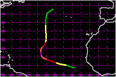
a. Synoptic HistoryHurricane Isidore formed from a tropical wave that had a
well-defined cyclonic circulation of clouds and was clearly marked at
mid-levels in the Dakar sounding data when it crossed the west coast of
Africa on 22 September 1996. Deep convection increased and satellite analysts
provided the first Dvorak scale T-numbers on the 23rd, while the circulation
passed to the south of the Cape Verde Islands. Thunderstorms became more
concentrated, T-numbers from the NOAA Tropical Analysis and Forecast Branch
(TAFB) increased to 2.0, and ship reports suggested the formation of a
surface circulation by 1200 UTC on the 24th. The "best track" begins at
that time, indicating the start of the tropical depression stage of Isidore. The tropical cyclone was initially located to the south of
a deep-layer anticyclone. It moved toward the west-northwest at 17-23
mph and intensified. An intense convective band wrapped around the center
and the system became a tropical storm on the 25th. Further intensification
ensued, an eye began to appear intermittently, and Isidore reached hurricane
intensity on the following day. The mature and dissipating stages of Isidore were influenced
by a well-defined mid- through upper-level low that was quasi-stationary
near 25°N 45-50°W through the 25th. The low then weakened and
lifted northward to near 35°N, but was reinvigorated there by its
interaction with a mid-latitude short-wave trough which passed by to the
north on the 27-28th. The steering currents on the east side of the low
gradually turned Isidore in a general northward direction. The forward
speed slowed to about 12 mph during the turn on the 28th, but then increased
to 23 mph on 1 October. During this period, Isidore reached its estimated
maximum intensity of 115 mph winds. The eye disappeared on the 29th and
upper-level westerly to southwesterly winds of around 69 mph contributed
to a shearing and weakening of Isidore, down to a tropical storm with
an exposed low-level cloud center on the 29th, and then to a tropical
depression on the 1st. Deep convection dispersed and Isidore transformed
to extratropical status on the 2nd. b. Meteorological StatisticsThe ship Magnific reported southeast (140°) winds
of 67 mph at 1200 UTC on the 30th of September, while located at 25.1°N
37.2°W, about 175 nautical miles from the center of Isidore. The reliability
of that measurement is in doubt because the estimated maximum surface
wind near the center was 58 mph at that time. This was the only surface
sustained wind report of 39 mph or higher to be possibly associated
with Isidore. c. Casualty and Damage StatisticsNo reports of casualties or damages were received.
Maximum
Intensity For Hurricane Isidore
| ||||||||||||||