|
|
|
|
|||||||||||||||||||||||||
|---|---|---|---|---|---|---|---|---|---|---|---|---|---|---|---|---|---|---|---|---|---|---|---|---|---|
|
1996 PRELIMINARY
REPORTS |
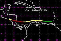
Hurricane Cesar caused at least 51 deaths and considerable destruction along its path through the southern Caribbean Sea and Central America. a. Synoptic HistoryThe precursor of Hurricane Cesar was a tropical wave which
passed Dakar, Africa on 17 July and moved westward for a few days without
development. The wave was accompanied by a large 200-mb anticyclone which
suggested a very favorable upper-level environment for development. Cloudiness
and showers began to increase when the wave was about 900 nautical miles
east of the southern Windward Islands on 22 July. When the wave neared
these islands, the 24-hour surface pressure changes were of the order
of -3.0 mb, (which is the threshold value that forecasters have typically
found to be associated with a developing system) and a surface circulation
center began to develop. The incipient center of circulation moved over
Trinidad and Tobago early on 24 July. This system produced rains and gusty
winds through a large portion of the Lesser Antilles. A post-analysis
of the surface data and satellite images indicate that a tropical depression
formed from the disturbed weather at 1800 UTC 24 July when the circulation
center was moving just to the north of the island of Margarita along the
north coast of Venezuela. The depression moved westward through the southern Caribbean
Sea and reached tropical storm status at 1200 UTC 25 July in the vicinity
of Curacao. Cesar continued its general westward track very close to the
coast of South America and gradually intensified. However, the development
was inhibited by the close proximity to land and it was not until 1200
UTC 27 July that Cesar reached hurricane status over the open waters of
the southwestern Caribbean Sea. Cesar began strengthening more rapidly
prior to landfall just north of Bluefields, Nicaragua, and it reached
its maximum intensity of 86 mph and minimum pressure of 985 mb near landfall
at 0400 UTC 28 July. Rapid intensification of tropical cyclones near landfall
has been observed in the past; e.g., Hurricanes Andrew
and Cleo over south Florida in August 1992 and September 1964. Cesar crossed Nicaragua and moved into the eastern North Pacific
where it reintensified and became Hurricane Douglas. The most recent hurricane
to hit Nicaragua before Cesar was Joan, a category
4 hurricane on the Saffir-Simpson Hurricane Scale, in October 1988. Joan also
redeveloped over the eastern Pacific and became Tropical Storm Miriam.
b. Meteorological StatisticsCesar was upgraded to tropical storm status based on a 46-mph
1-minute sustained wind and gusts to 58 mph observed in Curacao
at 1155 UTC 25 July. The central pressure in the best track associated
with Cesar while moving near the coast of Colombia is estimated to be
1 or 2 mb lower that reported by the reconnaissance plane at that time
because the storm's close proximity to land prevented the plane from reaching
the pressure center. Ship observations and the Hurricane Research Division
(HRD) surface wind analysis indicate that 39-mph winds extended northward
from the center for about 240 nautical miles. San Andres experienced calm
winds at 2128 UTC followed by 74-mph gusts marking
the passage of a portion of Cesar's center. The strengthening just prior
to landfall is supported observations from the reconnaissance plane just
before it departed the storm center. Data indicate the formation of an
eye at 0050 UTC 28 July, a closed eyewall of 15 nautical miles diameter
at 0256 UTC and a drop in the surface pressure of 3 mb in 1 hour. Satellite
images confirmed the strengthening at landfall by showing an embedded
center within cold tops between -54 to -63C corresponding to a T-number
of 4.5 on the Dvorak scale. c. Casualty and Damage StatisticsThere were 51 deaths attributed to Cesar.
Maximum Intensity For Hurricane Cesar
Landfall for
Hurricane Cesar
| ||||||||||||||||||||||||