|
|
|
|
|||||||||||||||
|---|---|---|---|---|---|---|---|---|---|---|---|---|---|---|---|
|
1989 PRELIMINARY
REPORTS |
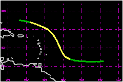
a. Synoptic HistoryThe tropical wave that spawned Tropical Storm Iris moved off the northwest coast of Africa on 12 September immediately behind the wave that spawned Hurricane Hugo. The tropical wave continued westward at rather low latitudes across the tropical Atlantic with signs of organization being evident on the 15th. By 1800 UTC, 16 September, the convective banding led NHC satellite meteorologists to classify the tropical system with a current intensity of 1.5 using the Dvorak technique. Thus, it is estimated that Tropical Depression Twelve formed at that time in the wave of Hurricane Hugo which was then approaching the Lesser Antilles. Tropical Depression Twelve continued developing at the normal rate of one T number per day and satellite classifications from NHC (KMIA), SAB and KGWC all were in agreement that the T number at 0000 UTC , 18 September , was 2.5 (40 mph). Thus, it is estimated that the depression reached tropical storm strength at that time 390 nautical miles east of Barbados. Ten hours later (1000 UTC) tropical storm warnings were issued for the islands of Barbados, St. Vincent, and St. Lucia anticipating that Tropical Storm Iris would track into the Caribbean due to its relatively low latitude. However, by 1200 UTC , 18 September, it was evident that the outflow from Hugo shearing Iris and that the circulation center was well to the north of the previous estimate. Moreover, 1200 UTC synoptic reports and satellite imagery indicated that the steering of the more northerly center would be to the northwest and thus the warnings were discontinued at 1600 UTC. For the next 24 hours, Iris persisted on a general northwesterly
track under strong shearing. On the 19th, animated satellite loops indicated
that the tropical storm developed its own outflow pattern beyond the outer
fringe of the outflow from Hugo.
Air Force reconnaissance reports at 1809 UTC on the 19th, when the center
was 235 nautical miles northeast of of Antigua, indicated that the maximum
flight-level winds at 1500 feet were 83 mph and the sea level pressure
was 1001 mb. The reconnaissance estimate of surface winds was 75 mph.
The estimate by both NHC and SAB satellite analysts was 52 mph which was
in better agreement with the pressure/wind relationship. An 80% reduction
in flight-level winds would have given a surface estimate of 63 mph. Thus,
it is concluded that Iris probably was just below hurricane strength at
that time. This is another example where a system east of the Lesser Antilles
is found to be stronger that the satellite estimates. (e.g , Tropical
Storm Earl 1986). b. Meteorological StatisticsSince Iris followed closely on the heels of powerful Hurricane
Hugo, there was no surface reports in the vicinity of Iris
because the ships vacated the region.
| ||||||||||||||
| Date/Time (UTC) |
Position | Pressure (mb) |
Wind Speed (mph) |
Stage | |
|---|---|---|---|---|---|
| Lat. (°N) | Lon. (°W) | ||||
| 19/1200 | 19.2 | 58.2 | 1001 | 70 | Tropical Storm |