|
|
|
|
|||||||||||||||
|---|---|---|---|---|---|---|---|---|---|---|---|---|---|---|---|
|
1991 PRELIMINARY
REPORTS |
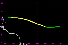
a. Synoptic HistoryA marked wind shift was noted at low levels in the Dakar
soundings on 5 September as a tropical wave emerged from the northwest
coast of Africa. The wave quickly aquired a banding-type pattern while
over the far eastern Atlantic. As the wave continued westward over the
Atlantic, analysis of METEOSAT images suggested that the wave developed
into the seventh tropical depression of 1991 at 0000 UTC on 7 September
while centered 270 nautical miles south-southwest of the southwestern
most Cape Verde Islands. The depression moved toward the west around 17 miles and
was upgraded to Tropical Storm Danny at 1200 UTC on 8 September based
on an analysis of Dvorak intensity estimates from the NHC, the NESDIS
Synoptic Analysis Branch (SAB), and Air Force Global Weather Central (AFGWC).
Under the influence of a strong subtropical ridge to the north, Danny
moved toward the west or west-northwest at 17 to 23 miles, except for
about 12 hours on the 10th when the forward motion was in excess of 23
miles. Although Danny changed little in strength between 0600 UTC on the
9th and 1200 UTC on the 10th, the minimum surface pressure of 998 mb is
estimated to have occurred near 0000 UTC on 10 September. At this time
the center of Danny was embedded within a central dense overcast. Later
on the 10th, the flow around an upper-level low centered near 22°N
60°W resulted in a shearing environment over the storm. Danny was
downgraded to tropical depression status at 1200 UTC on 11 September while
centered 180 nautical miles east of the island of Guadeloupe. The depression
dissipated by 1800 UTC on the 11th at which time an Air Force Reserve
Unit aircraft was unable to find more than a broad and ill-defined area
of cyclonic turning, characteristics of a tropical wave. The cloudiness
and showers associated with the remnants of Danny then moved toward the
northwest and north, eventually merging with a frontal cloud band over
the north central Atlantic. b. Meteorological StatisticsFigures 2 and 3 show the best track pressure and wind curves
as a function of time, along with the observations on which the curves
are based. The pressure and wind observations shown on Figures 2 and 3
are Dvorak Intensity estimates from GOES, METEOSAT, and DMSP satellite
imagery. c. Casualty and Damage StatisticsThere were no reports of damage or casualties related to Tropical Storm Danny.
Maximum
Intensity For Tropical Storm Danny
| ||||||||||||||