|
|
|
|
|||||||||||||||||||||||||
|---|---|---|---|---|---|---|---|---|---|---|---|---|---|---|---|---|---|---|---|---|---|---|---|---|---|
|
1988 PRELIMINARY
REPORTS
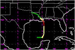
Tropical Storm Alberto (TS) |
a. Synoptic HistoryThe first eleven days of September were quite active meteorologically over the western Gulf of Mexico. Hurricane Debby passed across the Bay of Campeche from 1 to 2 September and made landfall in Mexico. Tropical Depression Ten formed and made landfall over east Texas/western Louisiana on 3 September, ahead of a cold front which would serve as the catalyst for Florence. The next day, the cold band accompanying the cold front had left the Texas coast and was entirely over the Gulf of Mexico. On 5 September the convective band moved southeastward and was located from Vera Cruz, Mexico to Tampa, Florida. The next day the band remained nearly stationary but began to split over the central Gulf as a frontal wave developed over the northern portion and began moving northeastward. Concurrently, the southern portion began showing signs of tropical organization. The surface pressures associated with the southern portion of the frontal trough were generally low. By 7 September convection had organized a spiral band structure but deep convection was for the most part transitory. A surface circulation appeared to have formed by 0600 UTC, 7 September while centered about 180 nautical miles northwest of Merida, Mexico. Tropical Depression advisories were began at 1600 UTC on that day and at 1800 UTC the depression was upgraded to Tropical Storm Florence when Air Force reconnaissance and satellite imagery analysis estimated that the surface wind speed associate with the system reached 40 mph. Tropical Storm Florence drifted generally eastward on 7 September,
following the remains of the frontal trough and then became stationary
the next day as the Atlantic as the Atlantic ridge built strongly northwestward,
bringing the frontal remnants. The steering currents were weak during
this period but the mean mid to upper level trough position was forcast
to remain essentially stationary over the lower Mississippi Valley. Thus
on 9 September due to the position of the trough and the strengthening
of the Atlantic ridge, the northward movement of Florence began. b. Meteorological StatisticsFlorence was a hurricane for only about 12 hours. The highest
surface wind estimated by Air Force reconnaissance was 98 mph at 2310
UTC on 9 September just before landfall. The highest sustained wind near
the surface was 81 mph measured on oil platform, MP73 (height unknown),
located near 29.3°N 88.9°W at 0511 UTC 10 September. The lowest
surface pressure reported by Air Force reconnaissance was 982 mb near
the time of landfall. An automatic Coast Guard weather station (8R3)
located at the Southwest Pass of the Mississippi Delta reported a surface
pressure of 987 mb with a calm wind as the eye of the hurricane passed.
The closeness of reliable observations within and surrounding New Orleans,
showed that the center of Florence passed quickly over the city and the
western portion of Lake Pontchartrain. 1. Storm Surge DataHighest storm tides were reported at the same time east of
New Orleans on the Bayou Benvenue which reached 7.5 feet above Mean Sea
Level (MSL) and on the Industrial Canal where the maximum height reached
6.5 feet above MSL. As the storm passed across the western portion of
Lake Pontchartrain the high water changed rapidly across the lake from
5 feet about MSL at the West End Marina at 0800 UTC to 4.8 feet above
MSL near the north end of the Lake Pontchartrain Causeway at 1200 UTC,
10 September. 2. Rainfall DataRainfall amounts were generally light for a hurricane making
landfall in southeastern Louisiana. The 24 hour rainfall amounts ending
at 1200 UTC, 10 September, ranged from 1.5 to 3.5 inches within 50 miles
of Florence's track. The greatest amounts were concentrated in the extreme
southeast portion of the state near the landfall area at the Jean Lafitte
National Wildlife Refuge which received a 24-hour total of 3.25 inches.
Another area of large rainfall totals were centered northwest of Baton
Rouge, where most stations reported totals near 2.5 inches for the 24-hour
period. It was in this area that the largest 24-hour rainfall total, 4.05
inches, was reported by a cooperative observer at Watson, Louisiana. 3. TornadoesThere were no reports of tornadoes over southeastern Louisiana
where Florence made landfall, giving an indication of the weak convective
activity associated with the center of the storm. Nevertheless, nine tornadoes
were reported in Walton County and one waterspout was reported in Bay
County over the Florida panhandle, far from the center of the hurricane.
Satellite imagery showed a significant convective band associated with
Florence, moving across the western Florida panhandle at this time. c. Casualty and Damage StatisticsThere were no deaths or injuries attribute to Hurricane Florence
in Louisiana, however, one man died in Alabama while attempting to secure
a boat in Mobile Bay. An estimated 20,000 people were evacuated from the
coastal Parishes of Louisiana, including nearly all 2000 Grand Isle residents.
Minor storm surge flooding ocurred mostly outside the levee system of
Plaquemines, St. Bernard, and St. Tammany Parishes. Grand Isle suffered
extensive beach erosion, losing approximately 40 feet of beach. Ligh to
moderate wind damage was mostly confined to trees throughout the parishes
of Orleans, Jefferson, Plaquemines, St. Tammany, and St. Bernard, causing
extensive electrical power outages. It is estimates that 150,000 people
were without power for some period of time during the storm. Total damage
from Hurricane Florence in southeast Louisiana is estimated to range between
$2 Million and $2.5
Million.
Maximum Intensity For Hurricane
Florence
Landfall for Hurricane
Florence
| ||||||||||||||||||||||||