|
|
|
|
|||||||||||||||
|---|---|---|---|---|---|---|---|---|---|---|---|---|---|---|---|
|
2000 PRELIMINARY
REPORTS |
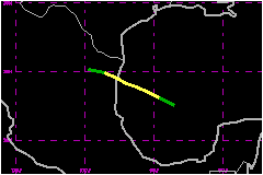
Beryl was a weak tropical storm that moved over the southwest Gulf of Mexico and across the northeast coast of Mexico, and eventually dissipated inland over the mountains of northern Mexico. a. Synoptic HistoryTropical Storm Beryl originated from a tropical wave that emerged from the coast of Africa with a closed circulation on 3 August. The wave tracked westward across the tropical North Atlantic and fractured into two separate entities - the northern portion of wave, which became major Hurricane Alberto, tracked northwestward, and the southern portion that tracked westward and eventually became Beryl. The southern portion of the wave produced little or no deep convection as it tracked across the Atlantic and into the Caribbean Sea. Not until the wave reached the Yucatan Peninsula of Mexico on 12 August did deep convection redevelop, mainly due to local diurnal heating. However, convergence of the afternoon coastal seabreeze fronts may have helped to concentrate the low-level vorticity of the wave and produce a closed circulation over the western Yucatan Peninsula. The wave emerged over the southern Gulf of Mexico and Bay of Campeche early on the 13th as a broad area of low pressure with a large closed circulation. Later that day, the wave was upgraded to Tropical Depression Five based on satellite intensity estimates and an Air Force Reserve reconnaissance aircraft observation of a broad closed circulation and surface winds of 35 mph. Tropical Depression Five tracked northwestward across the southwest Gulf of Mexico and reconnaissance aircraft found 1000 ft flight level winds of 61 mph at 1356 UTC on the 14th. Surface winds were estimated to be 52 mph based on an adjustment factor of 85% and the depression was upgraded to Tropical Storm Beryl at 1500 UTC. Beryl maintained this intensity and continued to track northwest toward the Rio Grande Valley area of south Texas and northeast Mexico. Landfall eventually occurred around 0700 UTC, 15 August, along the Mexican coast about 90 nautical miles south of Brownsville, TX or about 30 nautical miles north of La Pesca, Mexico. Beryl was downgraded to a tropical depression shortly after landfall at1200 UTC and eventually dissipated over the mountains of northern Mexico near Monterrey at 1800 UTC, 15 August. Beryl's lack of significant intensification may have been due to moderate upper-level northerly shear and entrainment of dry mid-level air located over the Gulf of Mexico.
| ||||||||||||||
| Date/Time (UTC) |
Position | Pressure (mb) |
Wind Speed (mph) |
Stage | |
|---|---|---|---|---|---|
| Lat. (°N) | Lon. (°W) | ||||
| 15/0000 | 24.1 | 97.0 | 1007 | 50 | Tropical Storm |