|
|
|
|
|||||||||||||||
|---|---|---|---|---|---|---|---|---|---|---|---|---|---|---|---|
|
2000 PRELIMINARY
REPORTS |
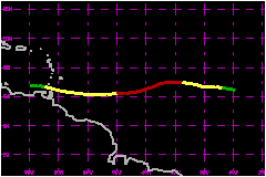
Joyce was an 92-mph hurricane east of the Windward Islands, but was weakening from a tropical storm to a depression when it passed through the Windward Islands. a. Synoptic HistoryJoyce emerged from the coast of Africa as a poorly organized tropical wave on 22 September. This was several days behind Isaac. But while Isaac moved northwestward and became a powerful recurving hurricane, Joyce remained far to the south. Joyce moved on an undulating, but generally westward track at 14 to 18 mph for its entire existence. Its center remained south of 13 degrees north latitude, under the influence of a strong ridge to the north that built westward in the wake of Isaac. The tropical wave showed signs of a closed low-level circulation on 25 September while located about 350 nautical miles southwest of the Cape Verde Islands. These signs were evident on visible Meteosat images and on SSM/I and TRMM microwave images. In contrast, a QuikSCAT pass on the 25th showed a shear line rather than a well-defined closed circulation. With the preponderance of the evidence in favor of a closed circulation, the "best track" begins with a tropical depression at 1200 UTC on the 25th. Convection associated with the depression became better organized with banding features. The cyclone is estimated to have become Tropical Storm Joyce at 0000 UTC on the 26th, although there is considerable uncertainty about this, as a QuikSCAT pass on the 27th still showed an open wave. Strengthening continued and Joyce is estimated to have reached its maximum intensity of 92 mph early on the 28th, while located midway between Africa and the Lesser Antilles. This was soon after the appearance of a short-lived "pinhole" eye feature on a TRMM pass. Visible satellite imagery later on the 28th showed the center partially exposed to the southwest of the deep convection, implying an increase in vertical shear. With occasional bursts of convection, Joyce's convective cloud pattern gradually became disorganized. Joyce weakened to a tropical storm on the 29th and moved across the Windward Islands and into the Caribbean Sea on 1 September while weakening from a storm to a depression. Joyce quickly and somewhat unexpectedly deteriorated to an open wave on 2 September while located in the southeastern Caribbean Sea just north of Venezuela. Data from NOAA aircraft GPS dropsondes on the 30th and satellite imagery suggest that a mechanism responsible for the above weakening was the entrainment of lower-tropospheric dry Saharan air into Joyce's circulation.
| ||||||||||||||
| Date/Time (UTC) |
Position | Pressure (mb) |
Wind Speed (mph) |
Stage | |
|---|---|---|---|---|---|
| Lat. (°N) | Lon. (°W) | ||||
| 28/0600 | 12.2 | 42.5 | 975 | 90 | Category 1 Hurricane |