|
|
|
|
|||||||||||||||
|---|---|---|---|---|---|---|---|---|---|---|---|---|---|---|---|
|
1990 PRELIMINARY
REPORTS |
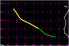
a. Synoptic HistoryA marked wind shift was noted at low to mid levels in the Dakar soundings on 29 July as a strong tropical wave emerged from the northwest coast of Africa. As the wave moved over the Atlantic, METEOSAT images suggested that the wave had developed into the fourth tropical depression of 1990 by 0000 UTC on 31 July while centered about 300 nautical miles south of the Cape Verde Islands. The depression moved west-northwestward and was upgraded to
Tropical Storm Cesar at 0000 UTC on 2 August based on Dvorak intensity
estimates from both the NHC and the NESDIS Synoptic Analysis Branch. Cesar
turned more toward the northwest on 4 and 5 August in response to a weakness
in the subtropical ridge to the north of the storm. Cesar became nearly
stationary on 6 August and was downgraded to tropical depression status
as the low-level center seperated from the deep convection in response
to an increase in upper-level shear from the southwest. The depression
dissipated by 1800 UTC on 7 August when the remnants were located a little
over 1000 nautical miles east-southeast of Bermuda. b. Meteorological StatisticsThere were no ship reports received at the NHC of tropical
storm force winds associated with with Cesar. c. Casualty and Damage StatisticsThere were no reports of damage or casualties related to Tropical Storm Cesar. Maximum Intensity For Tropical
Storm Cesar
| ||||||||||||||