|
|
|
|
|||||||||||||||
|---|---|---|---|---|---|---|---|---|---|---|---|---|---|---|---|
|
1990 PRELIMINARY
REPORTS |
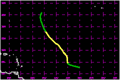
a. Synoptic HistoryThe ninth tropical depression of 1990 formed in the far eastern Atlantic about 600 nautical miles to the west-southwest of the Cape Verde Islands on 25 August. The seedling for this depression was a tropical wave which emerged from the northwest coast of Africa on 21 August. Curved convective bands visible satellite imagery suggested a cyclonic circulation, and the system was declared a tropical depression at 0000 UTC on 25 August after ship reports confirmed that the circulation was on the surface. The depression was about 800 nautical miles east of the developing Tropical Storm Gustav at this time. The tropical depresison initially moved on a west-northwestward track. The upper-level outflow became better establieshed and the system became Tropical Storm Hortense about midway between the Cape verde Islands and the Lesser Antilles at 0600 UTC on 26 August. On this day an upper-level low turned the storm more toward the north and also provided shear to slow development. As the upper low opened into a trough and moved eastward, its impact on Hortense diminished and the tropical storm resumed a general northwestward track. Gradual strengthening continued and the minimum sea-level pressure of 993 mb and a corresponding maximum 1-minute wind speed of 63 mph are estimated to have occurred at 1200 UTC on 28 August. Maximum winds held near 63 mph for the 24 hours beginning at 0600 UTC that day. By 29 August, Gustav had strengthened to a hurricane. The upper-level outflow from Gustav overspread Hortense, providing sufficiently strong shear to weaken Hortense to a tropical depression by 0000 UTC on 30 August. The depression turned more toward the north and was declared dissipated at 1200 UTC on 31 August about 700 nautical miles east-northeast of Bermuda.
| ||||||||||||||
| Date/Time (UTC) |
Position | Pressure (mb) |
Wind Speed (mph) |
Stage | |
|---|---|---|---|---|---|
| Lat. (°N) | Lon. (°W) | ||||
| 28/1200 | 22.3 | 44.1 | 993 | 65 | Tropical Storm |