|
|
|
|
|||||||||||||||
|---|---|---|---|---|---|---|---|---|---|---|---|---|---|---|---|
|
2001 PRELIMINARY
REPORTS |
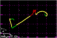
Tenacious late season Hurricane Olga roamed over the Atlantic Ocean for about a week. a. Synoptic HistoryHurricane Olga had a non-tropical origin and formed from the interaction of a cold front and a small area of disturbed weather in the north Atlantic. Five previous tropical cyclones and gale centers had already originated from a similar pattern in that area during this season. Olga was an uncommon event but not unique. There have been other late- or off-season tropical cyclones which moved southwestward across the Atlantic, such as Hurricane Lili during December of 1984. Surface observations and satellite imagery showed falling pressures and increasing weather in the area between Bermuda and the Leeward Islands as early as the 21st of November. A cold front reached the area on the 22nd, resulting in the formation of an extratropical low. The extratropical low gradually intensified and it is estimated that it transformed into a subtropical storm at 0000 UTC on the 24th, about 780 nautical miles east-southeast of Bermuda. At this time, satellite imagery showed the typical pattern of a subtropical cyclone with most of the weather within a comma-shaped cloud band located to the east of a low-level circulation center and a large area of gale force winds extending far to the north. During the next several hours, the thunderstorm activity markedly increased near an inner center of circulation which began to form, suggesting that the system was acquiring tropical characteristics. However, the wind field indicated that the system was a hybrid. The shower activity continued to become more concentrated near the center and a post-analysis of satellite imagery indicates that by 1200 UTC 24 November, the inner portion of the system had already transformed into a tropical storm. In fact, there was a hint of an eye feature on visible satellite imagery at 1545 UTC on that day. However, one can argue that the system was not purely tropical, because it remained embedded within the much larger extratropical circulation. The cyclone, now Tropical Storm Olga, moved slowly toward the northeast. As a high pressure ridge built to the north, Olga turned toward the west and west-southwest and gradually intensified. By then, satellite imagery showed well defined hooking bands surrounding a central dense overcast. Olga became a hurricane by 1200 UTC on the 26th and reached its peak intensity of 92 mph and a minimum pressure of 973 mb around 0600 UTC 27 November. From the 26th to the 28th, Olga made a double cyclonic loop as it interacted with a large-scale deep-layer cyclonic circulation that was pretty much isolated from the main belt of westerlies. Once it completed the second loop on the 28th, Olga became steered southwestward by another strong area of high pressure to the northwest. It then encountered strong upper-level northerly and then westerly shear, displacing the convection from the center of circulation. Olga weakened to tropical depression status by 1200 UTC 30 November, but a temporary relaxation of the shear, allowed deep convection to redevelop near the center. Satellite imagery suggested that Olga regained tropical storm status at 0000 UTC 2 December. By then, Olga was moving northward and began to make another loop, this time anticyclonic. Olga weakened as it was making this final loop and another
high pressure ridge to the north steered the tropical cyclone west-southwestward.
Olga gradually lost its associated deep convection and low-level circulation,
and dissipated by 0000 UTC on the 5th about 600 nautical miles
east of Nassau in the Bahamas. A vorticity maximum, embedded within a
trough continued westward across the Bahamas, the Florida Straits, Cuba
and the eastern Gulf of Mexico producing gusty winds and locally heavy
showers.
b. Meteorological StatisticsThere were several reports from vessels along the path of Olga. The most significant observation came from a German sailing yatch Manana Tres which apparently went through the center of the cyclone and reported a minimum pressure of 989 mb at 0900 UTC 24 November. This was the basis for starting advisories. The ship Liberty Sun encountered the center of Olga during the 25th and the 26th, and captured the wind shift and the pressure change associated with the tropical cyclone. Large waves associated with Olga spread onto the U.S. east coast, the Bahamas and most of the Caribbean Islands. In fact, some of the France's buoys reported waves in excess of 12 feet as far south as Guadeloupe.
c. Casualty and Damage StatisticsThe only report of damage came from the Manana Tres which indicated "lots of damage" during its encounter with Olga.
Maximum Intensity For Hurricane Olga
| ||||||||||||||