|
|
|
|
|||||||||||||||||||||||||
|---|---|---|---|---|---|---|---|---|---|---|---|---|---|---|---|---|---|---|---|---|---|---|---|---|---|
|
1995 PRELIMINARY
REPORTS |
a. Synoptic HistoryA tropical wave was at the coast of Africa on 27 July and was
a well-defined system as it was tracked across the Atlantic and Caribbean
over a 12-day period. It moved into the western Gulf of Mexico on 8 August. A weak low-level cloud circulation was evident from visible
satellite imagery on the 9th of August and aircraft reconnaissance on
the 10th determined that a well-defined low-level wind circulation had
formed. The tropical depression stage begins on the afternoon of the 10th
about 160 nautical miles east of La Pesca, Mexico and 225 nautical miles southeast of Brownsville,
Texas. The track from the 10th through the 12th was slow and erratically
westward with a sharp turn to the south on the 10th and a turn to the
northwest on the 11th. With sporadic periods of deep convection, the depression
strengthened to a storm on the 10th. The storm gradually intensified to
69 mph by late on the 11th, just prior to moving
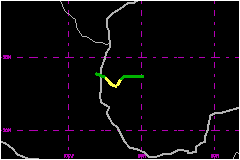
inland. Landfall was on the coast of Mexico just south of La Pesca and
about 150 nautical miles south of the U.S./Mexico border. Gabrielle quickly weakened
after moving inland.
b. Meteorological Statistics Gabrielle came close to hurricane intensity just before
landfall. The 84-mph aircraft wind speed measured
at a flight level of 1500 feet is the basis for estimating a maximum 1-minute
surface wind of 69 mph for 1800 UTC on the 11th.
The corresponding central pressure from an aircraft fix was 990 mb, but
a little later, a 989-mb pressure was reported when the center was too
close to the coast for the aircraft to monitor. It is assumed that the
central pressure was 988 mb at this time. There were no land or ship reports of 39 mph or higher in association
with this storm. The storm center was tracked with the Brownsville WSR-88D
radar on the 10th and 11th of August. A few radar pictures showing the
center were also received from Mexico.
c. Casualty and Damage StatisticsNo reports of death have been received and damage is estimated
to be minor. It is assumed that 40- to 69-mph winds affected the La Pesca
region. A newspaper reported up to 24 inches of beneficial rain in the
Mexican states of Tamaulipes and Nuevo Leon and flash floods were likely
over higher terrain. Storm surge flooding of a few feet above normal was
likely along the Mexican coast to the north of where the center crossed
the coast and some beach flooding occurred in southeastern Texas. Eight
hundred persons were evacuated in Soto la Marina and San Fernando on the
northeast coast of Mexico.
Maximum Intensity
For Tropical Storm Gabrielle
Landfall for
Tropical Storm Gabrielle
| ||||||||||||||||||||||||