|
|
|
|
|||||||||||||||
|---|---|---|---|---|---|---|---|---|---|---|---|---|---|---|---|
|
1995 PRELIMINARY
REPORTS |
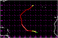
a. Synoptic HistoryHurricane Humberto developed from one of the several strong
tropical waves that moved off the coast of Africa in August of 1995. In
fact, Dakar, Senegal reported 58 mph winds at
500 mb when the axis of the wave crossed that station on 19 August. Humberto
was preceded by a strong tropical wave which eventually became Iris and followed by another strong wave which
triggered Karen. Satellite images and surface reports indicated a broad cyclonic
rotation associated with this weather system from the time it moved off
the west coast of Africa. However, the convection was disorganized and
displaced to the southwest of the circulation center due to the prevailing
northeasterly shear. Once the system moved westward over warmer waters
and into an area of lighter shear, it developed rapidly. A post-analysis
of satellite images suggests that it became tropical depression at 0000
UTC 22 August and reached tropical storm status six hours later. Under
an upper-level environment very favorable for development, Humberto became
a hurricane at 0600 UTC 23 August. Humberto's motion was rapidly influenced by a middle-level
trough over the central Atlantic and turned northward and northeastward
over open waters. Humberto maintained hurricane status until the 31st
when it weakened to a tropical storm. It was rapidly absorbed by an extratropical
low early on the 1st of September. Just before Humberto began the northwestward turn, it reached
its estimated peak intensity of 109 mph and a
minimum pressure of 968 mb. This occurred at 1800 UTC 24 August when intensity
estimates from the National Hurricane Center and the Satellite Analysis
Branch (SAB) reached 5.5 and 5.0 on the Dvorak scale. Thereafter, the
hurricane weakened some, primarily due to interference with the outflow
produced by Iris. Once Humberto moved away from Iris, it reintensified and turned northeastward
ahead of the extratropical cyclone which eventually absorbed it. b. Meteorological Statistics
| ||||||||||||||
| Date/Time (UTC) |
Position | Pressure (mb) |
Wind Speed (mph) |
Stage | |
|---|---|---|---|---|---|
| Lat. (°N) | Lon. (°W) | ||||
| 24/1800 | 15.7 | 43.2 | 968 | 110 | Category 2 Hurricane |