|
|
|
|
|||||||||||||||
|---|---|---|---|---|---|---|---|---|---|---|---|---|---|---|---|
|
1995 PRELIMINARY
REPORTS |
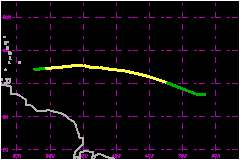
a. Synoptic HistoryPablo originated from a tropical wave which moved from Africa
to the Atlantic Ocean on October 3rd. The wave acquired a low- level circulation
and became a tropical depression at 1800 UTC on the 4th, while it moved
westward at 17 to 23 mph and was centered about 600 nautical miles southwest
of the Cape Verde Islands. Pablo became a tropical storm on the 5th. Its movement was
rather fast toward the west-northwest and then west across the tropical
Atlantic for the next three days under the influence of deep easterlies.
It is estimated that the storm's sustained winds reached their maximum
value of 58 mph on the 6th and then stayed near
52 mph until the 8th, when the storm encountered
very strong vertical shear and quickly dissipated while centered about
135 nautical miles east-southeast of Barbados. b. Meteorological Statistics
| ||||||||||||||
| Date/Time (UTC) |
Position | Pressure (mb) |
Wind Speed (mph) |
Stage | |
|---|---|---|---|---|---|
| Lat. (°N) | Lon. (°W) | ||||
| 06/0600 | 12.0 | 44.0 | 994 | 60 | Tropical Storm |